


Hello skiers,
We are moving into an active weather pattern by later Saturday though the middle of next week. That means powder days are ahead. It remains early season so there are thin spots and limited open terrain, especially upper slopes. The new snow in the next week will help open more terrain and refresh the existing snowpack.
There will be a little light snow (1-4) overnight and on Friday with a weak storm moving through. Saturday a high pressure moves in with a bit of sunshine possible, then the fun begins.
By early morning on Sunday, the snow will begins and falls though most of the day with a total of 3-7. Not bad but more to come. There will be a little new snow by Monday morning (2-4), then a break until Tuesday afternoon. A new storm Later Tuesday into Wednesday may be worth another 2-8. So, the hits just keep on coming. Not epic snowfall, but every bit helps.
There may be a break after that, but more snow will be coming by the weekend. The computer forecasts continue to show an active Cascade snow pattern into the end of the month.
Field report:
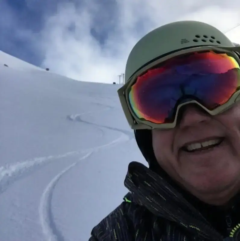
I was up at Crystal Thursday (today). Coverage remains pretty good for early season, but there are thin spots, a few icy areas and occasional rocks (top of six). Groomers are good, but again there is an early season low snowpack, so keep an eye out. We could use some new snowfall, and that is coming in the next week and beyond. I stayed at the Alpine Inn, always a treat and so convenient. The Elk had outdoor dining (& beer), plus take out that is fantastic good effort! I saw 100% mask usage at the Inn and on the mountain, plus good distancing - thanks everybody, keep it up!
Your Grand Poobah of Powder
Larry Schick - meteorologist
We are moving into an active weather pattern by later Saturday though the middle of next week. That means powder days are ahead. It remains early season so there are thin spots and limited open terrain, especially upper slopes. The new snow in the next week will help open more terrain and refresh the existing snowpack.
There will be a little light snow (1-4) overnight and on Friday with a weak storm moving through. Saturday a high pressure moves in with a bit of sunshine possible, then the fun begins.
By early morning on Sunday, the snow will begins and falls though most of the day with a total of 3-7. Not bad but more to come. There will be a little new snow by Monday morning (2-4), then a break until Tuesday afternoon. A new storm Later Tuesday into Wednesday may be worth another 2-8. So, the hits just keep on coming. Not epic snowfall, but every bit helps.
There may be a break after that, but more snow will be coming by the weekend. The computer forecasts continue to show an active Cascade snow pattern into the end of the month.
Field report:
I was up at Crystal Thursday (today). Coverage remains pretty good for early season, but there are thin spots, a few icy areas and occasional rocks (top of six). Groomers are good, but again there is an early season low snowpack, so keep an eye out. We could use some new snowfall, and that is coming in the next week and beyond. I stayed at the Alpine Inn, always a treat and so convenient. The Elk had outdoor dining (& beer), plus take out that is fantastic good effort! I saw 100% mask usage at the Inn and on the mountain, plus good distancing - thanks everybody, keep it up!
Your Grand Poobah of Powder
Larry Schick - meteorologist