


“Super” El Niño? What it could mean for PNW snow in 2026-27
Updated: Sep 28
Recorded live, September 23, 2026
Highlights, transcript and some of Larry's slides below.
You’ve probably heard the headlines: “Super El Niño.” But “super” is a hyped-up, unofficial term. What meteorologists are actually forecasting is a very strong El Niño for winter 2026–27—and Larry Schick says PNW skiers shouldn’t assume that means a bad snow year.
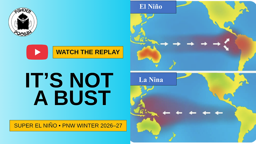
Larry looks at the developing El Niño, compares it with past very strong El Niño winters—including 1997–98—and breaks down what the latest temperature and precipitation outlooks could mean for the season ahead.
IN THIS FORECAST
Why Larry says a very strong El Niño does not mean a PNW winter bust
Why all El Niños are different
Why 1997–98 may be the best match for this El Niño
The concern about warmth, high snow levels and a possible slow start
Atmospheric rivers: “the good, bad and ugly”
What the latest winter precipitation outlook is showing
Ski-trip strategy: watch and wait—don’t book until there’s decent snow on the ground
Areas Larry favors: Tahoe, Telluride, Mammoth, Arizona Snowbowl, Taos and Wolf Creek
Japan? Go. Larry favors January.
Plus, audience questions about Whistler, Revelstoke, Sun Valley, Colorado, Alaska, the Indy Pass and more
TRANSCRIPT
This transcript has been lightly edited for readability. Larry’s forecast reflects the information available at the time of the September 2026 presentation.
Some slides included below.
Presentation
Larry Schick: We're going to talk about the El Niño winter coming up. You've probably heard El Niño already. The snow season will be affected by this El Niño because it's very strong and it's continuing to build. Just to make it clear, it's already an El Niño. It's just a matter of how strong at this point. We're sort of in the moderate to strong range, but we're building toward a very strong El Niño. Quick look at some of our wonderful sponsors, Andrea, Washington, AAA in Washington, the Hall, Beer Hall, and got Sturtevant’s and Alpine Therapy and Proliance. sports medicine there. So a lot of nice, great crystal, Silver Mountain, aren't tough. Crystal Mountain Hotels are a great place to stay.
Woolly has been a long time, 49 Degrees North, Vertical Grind, and the goggles there, you can get them at about half off. They have a great deal. Okay, so let's get into the program. All right, listen up. Listen up, young people. Let's hear about El Niño. But Daddy, Poobah says there's no guarantee. Well, there is no guarantees, but this one is so strong that the impacts will definitely be felt around the Western United States. So let's move ahead. You know, I like to get nostalgia right out of the gate. So I've got a picture of me at Whistler. From 1972-73, that was a big El Niño year. There I am right here, the Mustang.
This is, if you know Whistler, first of all, Whistler Village did not exist, nor did. Blackcomb, there was a garbage dump up there, but this is where the Creekside lift is, right up, it would go right up here, actually, and so this was the main lift at Whistler, went up to a roundhouse, there were some other lifts, and this was in January of 73, and so it was a little sparse, but you know, that's only 2,000 feet down there, you know, they got much better. snow higher up. So we're looking up from where Creekside. So Creekside would be somewhere, I don't even recognize where Creekside would be somewhere in here. There's snow in the parking lot there. And you know, here's another thing.
When I drove up there in '73, part of that road coming up from Vancouver was dirt. So that's how long ago it was. All right, here's another place that's really gonna benefit from El Niño, and that is the Arizona Snowbowl. And places in New Mexico will get a lot of snow. The last time I was skiing there back in the '70s, early '70s, '72, '73, the big El Niño year I had over 400 inches of snow and that's me getting big air with, look at that big hair. See, I did have hair. Look at the Robert Redford, red, white and blue sunglasses. Look at that. What's that folk? Old folks, those are straps around my, remember we had to have straps before brakes.
So it was quite the, and the banana boots, the whole thing, skiing and jeans, you know, the whole, the whole program. So the down vest, you know, the very, very 70s, but that was a big year down the southwest, lots of snow. through Southern California and especially Arizona Snowbowl in Arizona. They have about 2000 vertical there. It's pretty decent ski area. All right, so let's get right into it. We're going to give away give away the goods right now. It's a very strong El Niño is forecast. We're already in the moderate to strong range and still building.
And this is one of the biggest rumors I want to crush.
It's not a bust for Northwest winter. skiing or snow, and I'll show you specifically in just a moment. One thing I do think we've had in recent years, these slow starts to the season, you know, rain or rain mixed with snow or no, no precip at all. I think that will continue and these strong El Niño years also show these slow starts. So I think that just be ready for that possibility. Things have changed over the years now we do have snow making, so that helps around the edges too. Overall, El Niño is indifferent to cascade snowfall. That is, it doesn't show a favor toward above or below. So don't worry about this one.
OK, one thing that we have a continuing problem even in the non El Niño years is snow levels. We've had some more in the background with slow global warming. El Niño does tend to create some warmth, and I'll show you why in just a moment. And the oceans have been very warm in the last few years. And so that also. So if you look at the forecasts for December right here, December 2026, there's this warmth. This is called an anomaly. This is how much warmer than normal. Normal area of warm water down here, but it's much warmer this year and that's the forecast. Now it coincides pretty good with this 1997–98. This one right here.
These are the other strong El Niños here 1982–83 1972–73 I just showed you that one but you can see that was this one in 1997–98 this is what we're going to compare this year to because I think it's the closest anomaly and we'll kind of get a hint of what to watch out for and why that is all right first of all one page we're going to why is there weather period why is there weather well the sun heats the Earth differently from the North Pole to the equator obviously the equator areas are much warmer and the poles get very cold. The northern pole gets very cold in our winter.
And so what creates these storms is this contrast between this huge cool air or cold air up here that forms in waves and some of them migrate around. This is that vortex you always hear about, the polar vortex. And here's an example of it right here. So you get this stream that curves around and the storminess is right on the front side of these lows right in here. So in this case it would be right in here and the backside of it can be cold but not too stormy. So we follow those cycles as they move along and the computer models show us pretty well what's going on with those. And that's how we forecast the weather. And that's how the weather works. Totally different than a hurricane works.
These are called mid latitude cyclones. There are pacific storms and they get their power from this contrast of very cold air in the north colliding with very warm and moist air from the south. And that's what drives our weather and our storms here in the northwest. And of course our cold or warmer weather. Remember a lot of these storms have cold sectors and warm sectors too. That's Why we'll talk about atmospheric rivers in a second, too. All right, here's a good example of two very strong El Niños, probably in the range of what we're going to have this winter. One is 1997–98, and I told you about that one, and the other one's 2015 to 2016.
Notice I want to emphasize the Western United States. Notice the big difference here in 2015–16, quite a bit of precipitation in the Pacific Northwest, but It was forecast to be mainly in the southwest. It was a bust in the southwest. So I just want to show you that these things aren't 100%. They can go anywhere. I don't think this one is going to be like 2015–16. There's a reason for that. And one of the reasons is where the El Niño sets up in the tropical Pacific.
This this one on the left 1997–98. This is the one I think is going to be similar to this year. So California in the southwest Mexico gets hammered. In the Northwest, it's sort of a mixed bag.
It's sort of a little bit of yellowish and a little bit of green. That means kind of in the middle, a little bit on the higher side, a little bit lower. So I'm going sort of with right in the middle, near normal. Some areas will be slightly above, some areas might be slow below, but it's not a bust, okay? Here's where it may be more challenging is when you get into Montana and this extends up into BC too. So interior BC, Alberta might be problematic and that's probably or partially due to the warmth. And I'll show you where this warmth is coming from too in just a moment. So notice these difference, both strong El Niños, but quite a different weather pattern.
But I think ours is going to be similar to this one on the left. And if you take the other ones, they're more similar to the one on the left. Okay, so here's the official forecast from NOAA. I've talked to these guys many times when I was working for the Army Corps of Engineers. And so you can see it reflects exactly what I just showed you, this wet area through parts of California and the southwest. Colorado's sort of mixed bag. Part of Colorado will be close to normal, southern part might get above normal like Telluride, Wolf Creek, those areas that are kind of near parts of New Mexico and Arizona. Also Utah's in an equal chance, it could go either way.
I don't think anybody's gonna have a bust. problem area is going to be up through here. Again, parts of Montana and Alberta. Again, that's not definite either. Just be aware of that. And then here's the warmth part of it that does show it. And again, I'll show you in a moment why this warm part happening. All right, here's El Niño and La Niña in a nutshell. OK, you're looking at the Pacific Ocean to the right is North and South America. To the left is Australia and Asia. What happens is The normal situation is kind of like La Niña. A lot of the warm areas to the left there in the Western Pacific. And that's kind of normal. And La Niña kind of piles up even more.
And so that's kind of the normal situation or La Niña too. But what happens every two to seven years is this water piles up, this warm water, and then it sloshes back to the right or back toward the Americas. and it replaces cooler water here, and what that does, so why can that affect ours? Here's what goes on, is the warm water is really the genesis of thunderstorms, clusters of thunderstorms in the tropics, and they move back and forth, left and right, and they tend to concentrate where the warmest water is. And so they would shift from way to the left here, or into the Western Pacific, and shift over this way, and so what's that matter to us?
It matters because it affects our storm track and that happens mainly in the winter time. We don't really have a strong storm track in the summer, but there are some effects. So we don't get our effects again. We don't get our effects too until late December. So if it starts off slow and you're like, oh no, what's going on? Things change in late December, and they'll especially change in California if it starts off dry. All right, here's the kind of the two effects from La Niña and El Niño. Again, La Niña is more like normal. a more confident version of normal because this is kind of normally how it goes. It's cold up here.
We get storms occasionally here and it's kind of on the drier side down here. That's kind of normal. But here's what happened in El Niño. It energizes the southern storm track. That doesn't mean we have no storms. It just means that a lot of the stronger ones will be more frequent and stronger down through this neck of the woods. OK, so. Be aware of that. Here's again a look at those thunderstorms during La Niña and El Niño. You can see they set up into a different spot over the Pacific, more of the central and eastern Pacific during El Niño and more to the left or toward Australia and Indonesia during La Niña. And this is kind of near normal too. So that's what happens.
Creates different circulations. You can see the circulation as they change around. But again, that telegraphs certain information to the jet stream. And also the jet stream is becoming closer to this area in the equatorial Pacific where the thunderstorms are and they can get energized with a little bit of extra moisture too. All right, so we've gone through the summer and I gave you a heads up on this earlier that we'd have a lot of snow in the Andes and sure enough, we've had over 400 inches in Portillo. Now Portillo, Chile is about the same latitude is San Diego.
So it'd be equivalent to the snowfall that you might get at Mount Lemmon in Tucson or the local mountains in Southern California. And they normally have maybe 200 inches or 250, but they've already had 401 inches. In fact, it's fun to go look at their camera. You can see people skiing during the day. I mean, it's beautiful there. And we have little or no connections to the West Coast in the summer with El Niño, except for one, I'll tell you that in a moment. And so I don't know if you've heard about the hurricane season in the Atlantic. We've had zero so far, very rare. I'm not sure if it's ever happened. We've had zero hurricanes so far named hurricanes in the Atlantic.
Now in the East Pacific, we have a ton and very strong ones too. This latest one called Polo hit a category five, which is super rare and super strong. This is a picture over yesterday. It backed off a little bit today. It's off the coast of Mexico. Looks like it's gonna go just south of Baja and then maybe cut through weaken and then cut through central Baja and then moisture will go into Arizona and the southwest. But for now, it is a monster. I mean, perfect I 180 mile per hour winds, one of the one of the fastest deepening or strengthening hurricanes ever recorded.
It went from a tropical storm, which is less than 74 mile an hour winds to a category five in less than 30 hours and just incredible strengthening. It's just magical how these things can deepened and quickened so fast. It's there's a magical thing. I'll explain it one of these days called latent heat of condensation. It's just like a magic machine of energy that takes this warm, moist air in this warm ocean air, this fuel and converts it into energy and heat. It's a heat engine essentially is what it is very efficient, very different. kind of mechanism than our storms in the Pacific. There again, remember, those are from the contrast of this very cold and warm air.
This is all about that latent heat of condensation. It's an incredible process. One of these days I might explain it. It's just it's like a magic trick. It's awesome. All right, so here's the worldwide impacts from December through February. So, you know, aiming toward the northwest. It's warm through this area. Again, I'll show you in a moment why that is. And then it's kind of wet down through here. But other things I want to point out, because we always get questions, look at Europe, no, almost really no effect in the Alps. It's too far away to really affect. And so you're only going to get effects mainly through the Pacific Basin.
And some of those effects, remember Australia's gonna be in summertime when we're in winter. And so those are different effects. There might be heat waves and stuff like that. A lot of questions, we have them every year about Japan. All right, here it is. Japan, if you're gonna go there, I know a lot of people from Seattle go over there 'cause I'm always getting this question and there's trips and all sorts, and I hear the skiing is fabulous.
And so mainland on the North Island there, there is a little bit of a warm bias tour with El Niño but here's the here's the catch go in January any year go in January because that's the best time to go with the best snow and the coldest conditions so all right that's that's when to go and that's what to do all right we're going to go through a few we're going to go through most of the Washington ski areas and compare them exactly what happened during the last during 1998 versus normal. OK, because I want to show you this. This is the year that it's going to be similar to. So the first one, Snoqualmie Pass. All right, slow start right here. This is what happens. Slow start.
Still some snow, but slow start. And then by first of the year, climbing early before Christmas, climbing snow. And that's exactly what we expect. You know, maybe not as slow start, but the starts have been slow lately anyway. And then look at this. It just bounces around above normal, kind of close to normal. And then by April, it tapers off. So that's pretty good. The next one is Mount Baker. Starts off slow, then it builds again, and then it kind of goes right near normal. So no big deal. Don't sweat it, okay, folks? And here's Mission Ridge. Slow start, actually kind of near normal, and then builds really nicely. over the year, great year for Mission Ridge there in '98.
Here's this, this next one is, where is, okay, this is Mt. Hood Meadows. All right, now in Mount Hood, slow start, and then it goes right near normal, no big, and these other lines are different years, you know, so you can see the middle is the average, but these are some of the really bad years. 2005 was bad, 2015 was bad, so those are the bad years.
This last one here is, is white pass okay so you can see right here it's pretty close to normal and this last one's crystal we've lost some information here but I suspect it just followed the same path right up around the first year it just climbed up to above normal and a really good year at crystal so enjoy that that would be nice so if it's anything like that year so again this crushes that idea now this is not as true for the moderate and weak El Niños so we've had enough examples to show there is a difference between the really strong ones like this one coming up and the kind of moderate to weak ones, which do show a little bit more of this bias toward dry and warm and problematic.
Again, here it is in a nutshell, the storm track way through the southwest, favoring California, parts of Arizona. But this Here's another thing, folks. This doesn't mean like the week you're gonna be there, it's gonna be perfect, or it doesn't mean it's gonna be a bus. It's still weather. This is just a generalized thing. Personally, I don't know how you can even plan in some ways. Unless you have a season pass, I think it'd be more favorable. But in my opinion, you're either gonna ski or you're not gonna ski. Come on, get with it. All right, here's an interesting precipitation forecast for this winter. So here's what they use. It's called the ensemble mean.
Ensemble is a technique of forecasting. And what it means is you gather all these models and do different variations of them, and you throw them all into the mix, stir it up, and whatever is the average, that's what they think. So they got all these models, 51 models, threw them all together, and each one has a solution of what's going to be, and this is what it was. And it shows this wetter pattern right here through the southwest in California. And we're even though we're on this brown side, it's kind of whitish brown. It's like right near the middle. So but it does show a little brighter again where that spot is.
I told you through Montana and the Rocky Northern Rockies there, Colorado kind of mixed bag. Utah shows a little bit better in this forecast than it does in some of the other forecasts, so that's that's good.
So that's. how we forecast that's the best way to do is compare to other years that were similar and we did that with 1997–98 and then we start comparing it to models and see how it goes and then in the end we just start tracking it in December okay how how's it going how close is it but um well I'll have some other ideas for you in a second here here's some of the other winter precipitations in the strong uh El Niños these 2015–16 uh that was one 1982–83, that was a big one in California. I remember had a season pass to Kirkwood. Oh my God, it was great for a month. And 1997–98, that was really nice. So, and you can see these more moderate ones, the signal isn't quite as good, you know?
So when you get to moderate and light ones, it's different. So there's a subtly, we'll worry about that in another year. This is gonna be a strong one. And I'm convinced it's not gonna be. like 2015–16 it's going to be more like 1997–98 okay we got to remember this sit down the atmospheric rivers do come regardless of the uh El Niño uh phase and so those create high snow levels you know you've seen them you love them you can't live without them we used to call it the Pineapple Express it's called atmospheric River and what these are they are um conveyors of moisture from the tropics and subtropics and they're ahead of the actual front. So the front would be like right in here.
Low pressure and cold air would be here. This would be warm air coming up. There's Hawaii right there, okay? And it's coming up and it's raining like crazy. This produced a big flood, by the way, in Oregon. I just like this picture. It's 20 years old, but it's just a great picture. It shows like an outstretched fist coming right at you, you know. So I skied in this storm. I remember the day I was up at Crystal and it started off great, but it turned wet and sloppy by noon. I ditched out of there quick, but I knew it was going to change because sometimes here's the deal with these atmospheric rivers. Sometimes they start off kind of cold.
It's cold in the Cascades and you get the precip and it's actually snowing pretty good. And then it warms up and it gets really sloppy. But also if you get north of it, Like in this case, if you got the Baker or Whistler, it'd be in the cold part of it and it'd still be precipitating, but it'd be colder because in the south part, be really warm. So this one, the snow level might be seven, eight, 9,000 feet in the core, but it might be four or 5,000 up here and it might be even 10,000 down here. So you have to see where these are going and where they are exactly in the Cascades to get a good look. All right, here's another look at the El Niño forecast.
Okay, so This graph, these are actual temperatures above or below normal, and this is for El Niño. Anything one or above is El Niño territory, so we're already... over two, which is in the strong rate. And so we're already in the strong to very strong range of El Niño right now. That's where we're starting and we're going farther. This is October, November, this is December. So we're going to peak out about here. This doesn't mean it all ends here because look at we're still really warm here. This again is the temperature in the tropics and this is how it's measured. El Niño has measured
the strength of it. Okay, so you can see there and these are kind of different models.
This is kind of the average. Look at some of these models. Pull it way up here over a three. Now, the highest it's ever been is about 2.7, 2.8. So we're close to the highest ever. In fact, some of the models extended over that. So I'm going to take it below. But even the worst case scenario, it's still going to be a very strong one because this is the worst case scenario here. I just want to show you, we're not going to slip back into moderate. or anything else. We're not going to slip back into neutral or anything else. It's going to be El Niño. It's just how strong is it going to be, okay? So that's a pretty obvious one to look for. All right, here's another thing to look at.
These are from 1850, all the El Niños, the strong ones, one back here in I think 1876, but these are the more recent ones. Here's that 172 I was talking about at the beginning, nostalgic El Niño for me. 1982–83 of another nostalgic one. This one, too, was it was good. This was the dog right here. 2014–16. Actually, it was kind of weak in the beginning of 14 and 14 and then kind of strengthened. But you can see the forecast to the extreme right of the one we're talking about this year. And it could be the biggest on record or it could be equivalent to some of these other big ones. All right. We all got that. All right. Let's move on here. So this one I want to show you real quickly.
Like how is this different than normal? Okay, this is kind of the normal thing. We have low pressure in the Gulf of Alaska. That varies every winter and every week. But in a general sense, we have this low pressure over the Gulf of Alaska, pulls down cold air out of the north, brings up warm, moist air, creates storms. Okay. And that makes it for cool and moist generally over the northwest, northern California and interior northwest, inland northwest. That's sort of our weather in a typical winter. There's a polar jet stream or cold air over Canada that plunges into the country. Sometimes this brings storms too. And then so there's a specific jet stream that kits us.
Sometimes it's parts of California, even Southern California. Sometimes it connects with the subtropical jet stream, which which has some moisture down the southwest. So that's kind of normal. OK, see what normal looks like. Alright, this is what? El Niño looks, it shifts things around. So think of El Niño as a temporary climate shift. for only a few months, but it creates some havoc. It doesn't create climate shift over the whole world. It's more specific in North and South America. Okay, so again, here's El Niño to the south here, the warmer ocean and and so it creates these thunderstorms down here and it bends a storm track.
So we get a more energized southern storm track and affects California in the southwest. And here's I've been talking about this halfway through the why it's so warm in the northwest. Well, there's a couple reasons this high here that tends be preferred during this El Niño. It sets up over central Canada and it does a couple things. It blocks very cold air from coming to the north. So we don't get those really cold air masses. We might still get a few, but it does suppress it. And so we won't get a lot of those really cold powdery days. We'd still get some, but it just makes for less. So it brings this air up like this blocks those. Here's another thing.
This low also brings up mild air from the south. So both of those things, this one from this high pressure and this low pressure, bring up mild air, blocks cold air. Those things all add up to the warmth. Added to that warm is global warming in the background. It's worth a degree or two and these warm ocean temperatures. And again, this southern storm track, very energetic, you know, and that's what's going to cause all the havoc in California. Again, it's not a it's not a done deal. It's like 70 to 80% chance, which is very high in the world of weather.
I've I got to tell you, in my years, decades of forecast, I've never seen a long range forecast that I was very confident in, except for this one, you know. And even this one's got its flaws. Come on. They're not perfect. But this kind of strong El Niño, I would make a bet on. It's the only one I'd ever make a bet on. But remember, all must bow to El Niño. You must know that. Of course, this is Chris Farley and Saturday Night Live doing El Niño or what he called the Nino. All our all El Niños are different. For North, it's not a bus, but sometimes a struggle, especially in that inland Northwest. So here's another thing.
Be careful of all the hype headlines you're going to see El Niño blame for everything you even think of. And so just be aware that I think I've straightened out most of the things that will happen. The warmth is that we're stuck with it, I think. And it's not every storm, too. It's not every storm, and it's not even one storm might be warm at the beginning. Cold at the end. That's generally how it goes. You get warm air ahead of the storm and cold air behind it. So just remember that when storms come in, so don't write it off right at the beginning. In fact, we're going to have a storm coming up later this week, Thursday and Friday.
It's going to be warm initially, but the snow is going to go down to about seven, six, seven thousand feet. So we'll probably get some snow in the higher elevations. come Friday, Saturday, so watch for that. We've already had a little bit up at Crystal about a week ago. I think we'll have this slow start. I mean, it's least questionable. A lot of travel people ask me traveling. I always say this any year El Niño or whatever and you're if you don't book until you've got snow on the ground. That's my rule of thumb. If you have to book his grandma lives near Taos. then just do it, I guess. But don't book until decent snow is on the ground. That's especially true of some areas in New Mexico.
But I would favor places like California, Mammoth. and Tahoe Telluride, the southern Colorado. Let's have one in southern Utah near St. George. Brian Head Brian Head Arizona Snowbowl. They're one of the targets. They've done really well. Tahoes, but wait till there's snow on the ground. Wolf Creek and what's the monarch there in southern Colorado? Again, January, everybody was asked favorite January. That's where I go. OK, and so so kids, that is the story of El Niño. And guess what? In 50 years, there'll be flying cars and a thing called the internet. All right, thanks, everybody. That's El Niño winter 2026.
And I'm the Powder Poobah, but I'm here as long as you want me, and I'd be happy to take any questions. So Andrew's been monitoring that. Lay it on me if you've got any, if you want to argue any of those points, I'd be happy to do that. But let's see how it goes. Thanks, everybody, and thanks for coming by. It's gonna be fun. Every season's fun, all right? And by the way, This picture right here, this picture. What lift do you think that is? Anybody know any of that one? This is Peak Chair at Whistler. And this run right here where this little gully is right here, it's called the coffin. It's probably one of the hardest runs at Whistler.
If you ever go over the chair and look, you have to take a route just to enter the coffin. You have to take this route with bolted with a bolt and ladder system and ropes just to get to the front of the run, not even to the run. It's scary, the approach is scary. But anyway, I've never been on it. I've seen it. I've seen guys go and I'm like, I wouldn't get close to this. Anyway, you'll see that run as you go. It's a peak chair. All right, Andrea.
Q&A
Andrea: Okay, so I emailed you a few questions and then I have a dozen or more. Why don't you just verbally tell me? Yeah. OK, let's get the Japan thing over with because a lot of people-- Oh, yeah. Sorry. Here's the question. I forgot about that. Japan.
So the Japan thing, go in January. I said it a couple of times. There's just no debate about that. It's too early to tell. You never know the week you get there until the week you get there. But if I had to book a trip right now, that's what I'd do, all right? Again, where to go if you're traveling, favor Tahoe to Mammoth Southwest in Arizona and New Mexico, kind of southern Colorado. It doesn't mean like Utah and Colorado or Wyoming or those places are a bust. I'm just telling you what these weather patterns will favor. In fact, you know, it could be quite good. You know, it does. Okay. One guy said, Fog is a deal breaker for me, darn it. Can it be predicted?
Fog is the worst thing, I gotta admit. I was up in 7th heaven last year, got off that lift and I've been off that thing a bazillion times at Whistler. I could not see two feet in front of me. I was terrified. You'd make a wrong turn there, you're gonna hurt yourself. So anyway, here's a couple things with fog. So there's long-term and short-term fog patterns. And we have a lot of fog in the Northwest because we have this moist ocean air that's always close. And it does spill over the Cascades into places like Schweitzer upski there many times in the fog, couldn't see. And then Whistler too. And there's layers of fog too. So some of the fog is just a cloud on the ground, OK?
And so sometimes the cloud just stays. very low elevation. Sometimes it's medium elevation. Sometimes it's rare at the peaks. So there's layering and sometimes here's makes it difficult, more difficult. The cloud clouds can start on the ground and then they lift during the day. So fog can lift to a low cloud deck. One of the other things bad about fog besides you can't see is it makes the light so flat. You can't see a bump in front of the clouds, the sky and the snow looks the same. And so you can't tell what you're doing. So I'm with you, buddy. I I hate the fog too, but this part of the Northwest. Yes, Andrew. So is there a way that we know what to expect? Is there a fog? Up for fog?
Yeah, we have forecast. Yeah, there are. I mean, a lot of times the fog is a short term phenomenon. It might be just the morning. Here's what I do. I mean, I just look outside, look out maybe on the cans and see, OK, how much of the mountain is covered in low clouds and just look at different elevations to remember that. And then there's some widespread fog patterns and sometimes it's just layering and again it changes through the day. So it really is difficult to predict in any long-term sense. Even aviation is a big problem. Fog is a big problem in aviation, right? And so aviation forecasts, they have to constantly update those sometimes in the fog. And it's very imprecise.
It's hard, I admit it. And I get stuck in it if it makes you feel any better. And I really pay attention to this stuff. There are, again, short and long-term fog patterns. They're worst on the west side, but the east side gets them too, you know. Mission's got it. Schweitzer's, I've seen bad there. Eastern British Columbia, I've seen it bad there. You know, so. Fog happens. So Hannah Boley, why is this upcoming El Niño more similar to 1997–98 versus other strong El Niños? Great question. So I touched on this a little bit. First of all, that one in 2014–16 that was kind of more centered toward the Central Pacific. And so it did kind of bend the storm track a little bit differently.
And this one is more similar to 1997–98, not only in strength, and current strength and forecasted strength, but also in position. And so that's why I use that as a comparison, you know. Also, we had another question. If these don't answer your question, just have follow-ups. Of course, this Antarctica, somebody's going down to Antarctica in October, November. I assume they're going skiing. You can ski down there. There's a firm amount of Lake Tahoe that takes people skiing down there. I mean, it'll be that's really marginal. It'll be cold and unsettled, believe me.
And that's the early go down there pretty much October, November, because that's just starting their spring, but it's still unsettled. It'll be cold, but I mean, it'll be once in a lifetime experience. But you know, you got to get through the Drake Passage. That's 700 miles from tip of South America. That's a rough piece of real estate. So. Anyway, I'm so I like this question on. So is this winter going to be better than last year? Or let's just say, how different will it be from last year? Oh boy, OK, so it's hard to compare one to another, but I think it will be similar in this way. It'll have a slow start. I think it'll be what I would consider kind of normal.
You'll have some good days and good stretches. and you'll have some that are poor. It'll be variable. In the end, here's how we kind of measure in the end with snow. We measure about April 1st. And so in the end, I think most areas will be within 10 to 20%, a plus or minus of that. of that April 1st normal date. So believe me, when you get 20% below normal, it's not it's fine. Again, it does depend how it comes in. You know, sometimes they'll come in crazy for three weeks and then be flat for a week. Sometimes they'll come in really consistently. Sometimes they'll be front loaded in the season, back loaded. There's all sorts of variations. That's something we just don't know.
You know, that's why you have to pivot on the short range forecast if you got the time and space to do it. And OK, thank you. That was from Frank Pita. I'm so JM says what are the chances of another set of destructive early season storms? Or a slow start to the season like 2025. So yeah, so that was a big big flood we had that that did take a pounding on the snowpack and plus it didn't add anything. We got a lot of rain, you know. I've done a lot of studying of these atmospheric rivers, 'cause when I was with the Army Corps of Engineers and flood control, we had to know the best practice for these atmospheric river storms.
And so what I came up with, there really is not, even in California for El Niño, I'll get some pushback on this from some scientists, but in my opinion, the worst storms, and I would consider that December one, one of the worst, the worst storms, don't align themselves with any particular phase of El Niño, La Niña, or neutral. They are random. Again, this is not all the storms. This is only the worst ones, the top one or two in every little basin. it's really unknown and serious people that do flood control, they prepare every winter that it's going to be the worst. They're prepared every winter. It doesn't matter, you know. So that's how that's how I kind of look at skiing.
You got to prepare for every winter being the worst or the best, you know. But I got to tell you, this El Niño does favor, you know, certain things. So it's so strong. It just gives you great, great confident. The confidence level, nothing's 100%, but it's the confidence level. That's what I'm trying to communicate to everyone. Just the confidence level is very high because this thing is a monster. Again, El Niño is not going to come and visit us, right? It just creates this environment for certain things to happen. And so that's the prediction part of it. Okay, so we have some specific questions about locations and I'm going wrap them all into one.
So number one would be Alyeska, Sun Valley, best time for Whistler. What about Revelstoke? Oh, my. OK, I'm going to have to go back to see about Alaska. Start about Alyeska. Yeah, that's up in Alaska, right? So let's see what it says up there. I don't think there's any. Oh, it's so it sort of goes warmer than normal up there. So That's what I have to go with. You know what? What month? I don't know. I mean, again, wait, wait if you can wait and see what how it develops. Make sure there's snow on the ground before you book. That's that's the best rule of thumb. You know, no matter where you go, even this winter down through the Southwest, maybe have your plans go.
But if you're going to pivot, I know it costs more to wait for the airline tickets, but consider it like insurance. OK, what were the other ones? Sun Valley Sun Valley. Yeah, Sun Valley. OK, Sun Valley. Sun Valley does get some of these storms that go into California. Sun Valley like the ones that go into Tahoe. A lot of them push beyond this here and go up into southern Idaho. I'd be fairly optimistic and they have extensive snowmaking there, of course, so that's a positive part of Sun Valley too. They can. They can open with pretty much no snow and so I mean I love that place. Come on 3000 foot. groomer and warm springs top to bottom. I love it.
I'm sorry, what's the best time for Whistler mid late to mid to late March or early April? OK, that's a really good question. You know here in the Northwest we ski. You know if you go out out to Canada, Whistler is the easiest place so I always ski late season at Whistler 'cause the snow is always good. The prices are better. The Here's what I've found. I think late March, early April, it's kind of the same. If I was going to book something now, I'd just go for the first week of April because by the second week or they start to close down some of the lifts. So they still have them all open the first week, but then they start buttoning it up, especially over on the Blackcomb side.
So just be aware of that when you're booking. I like that first week. I try to find a good spot, but they have some big festivals up there too, so beware of that. It's the crowd situation there. I love skiing because the days are so long, you get off skiing at three or four and it stays light till 9:00. It's fun. So I like that time of year. I also like to go early at will, so you'd be surprised how good it is early in the year. They do a good job of snowmaking, plus that alpine area. I've never, and I've seen it in the absolute worst years ever. I've never seen that Alpine area unskiable early in the year that might not be open.
They don't always open the lifts, but they always have enough snow up there. I swear they just need one storm and it can open. But again, they don't open it all quickly. I've seen plenty of snow. It just drifts in up there above the Roundhouse, you know, Harmony Bowl and those big bowls. I think 7th Heaven needs a little more snow. But anyway, that's my opinion on Whistler. Okay, and so on Whistler, Sorry, was the coffin damaged by the rockfall last year? Is that was- Oh, really good question. When you were there last year, I was up there. I was up there when that rockfall happened. And no, it wasn't damaged. It was off to the right kind of over Whistler Bowl. And no, it wasn't touched.
And yeah, that was pretty wild. You could see it pretty good. Everybody was a little spooked. But no, it did not touch the coffin. OK, then what about Revelstoke? So Revelstoke, you know it all depends if you're talking about the ski area or heli skiing up there. You know heli skiing gives you a little more flexibility 'cause you can get the north north facing peaks and certain other things. I'm not saying it's a bus, I'm just saying that's that's area may struggle a little bit. So again, I think it's one of those areas you should, you know, wait to see how if you can wait to see how develops and then make your decision. OK, what about Aspen and Jackson? So both those plays love them.
I think Jackson's Jackson is sort of partially in this warm, warm spot area. I think I see if you know you can see on this warmer and they don't get as much on the southern soundtrack storm track, but. it's still, it will be blocked to some degree. Here's another thing, it'll be blocked to some degree from this. See this high pressure here? So this is going to block some of those inside sliders, we call them, these storms that come along the Rockies. And along the eastern part of the Sierra or parts of the Rockies, this this will tend to block it. It's not the whole remember these these patterns aren't the whole season. They're just a preferred pattern.
So I think Jackson will be, you know, wait, watch it. Targhee too. It's on the other side there. And what was the other one you asked for? Aspen, Aspen, Aspen. So Aspen sort of stuck in the middle. I would just say kind of normal if you look at the Colorado. snowfalls, they were kind of near normal during that 1997–98. It was not it wasn't bad, you know. And so on that, someone says, what about the Colorado Front Range forecast? The Front Range? OK, so, you know, they're serving the same boat with, you know, most of Colorado sort of right in the middle of neutral. It's El Niño serve indifferent.
I'm going to use this word indifferent a lot because If you look at it all, it's sort of some years it's good like we just saw went through the all the Washington ones. There were some good years that 98 was a good year and so, but some years aren't as good. So I'd say sort of middle ground there. It'll be fine again. Don't book until you see snow on the ground, OK? OK, so on that someone says, have you ever met a ski area that you didn't like Larry? Yeah, that's a good question. I've been to over 70 ski areas, so I've been to a few. Have I ever met one I didn't like? Not really. You know, anything with, you know, new snow, loose guys and you're with a few friends coming on. Can you beat it?
OK, just everyone. Yes, I I'll be posting a replay in a couple days and it'll be on the link. the website which I will put here and e-mail to everybody um okay so Karen Johansen asks what areas or resorts in the southern hemisphere might have good snowfall next summer? Oh next summer oh God it's a lot of days away here's the answer get down there it's still going on the season is still going on go there now uh there's flights from um LA and Atlanta to Santiago I know I just took one six months ago all right you can be down there in nine and a half hours and and it's a two-hour drive to Portillo. You can be there by tomorrow afternoon. Get on the plane.
What are you waiting for next summer for? Karen, go now. I gotta tell you, I don't, this was very predictable. I mentioned it. You know, three or four months ago, watch Portillo. It might be good, and sure enough it was so. But I gotta tell you, Portillo isn't that great for a lot of years because it's just they're just too far north ladder too far close to the equator. It's like San Diego Mountains, you know, they just don't get that much snow, you know. So I would go. I go now. What are you waiting for? Come on.
So Paul Klem has just added some. data points in the chat about these are the highest ski area peaks in southern Colorado, New Mexico, Arizona, Taos, Silverton, Santa Fe, Arizona Snowbowl and Ski Apache. Okay. Anytime skiing, the higher you go, the better you're going to be, you know, so I don't, you know, yeah, there's this warming in the background. And so the higher the better. But each individual storm has its own characteristics to remember that. It's just in general, you've got to you've got to go with the better. Yeah. Thanks. Thanks. That's good. I can't breathe that high, you know? So Eric Popolski says, hey, what about the Northeast US? Oh, I don't even pay attention to them.
They're skiing in the Northeast. What? I don't know. Let's see what's what it looks like. And then I have what would what would El Niño say? I must ask him. El Niño, what do you say? All right, let's see what's what's to say here. There, here we go. Well, you know, there's some colder air that generally might plunge into the Northeast, so that's good for snowmaking and any storms they might get, you know, but it doesn't look like the climate impacts show much of anything. Let's see that that forecast, the winter forecast show anything? Um, oops, how about the kids? Um, yeah, I don't know. You mean you would stop on the east coast and not go all the way to Europe? What are you thinking?
Um, or go to Japan? All right, here it is. All right, so, so, so yeah, it looks like there's some moisture up there and It's going to keep warm too, so that doesn't bode that well. I mean, they struggle enough there with warmth and ice and snow and you know the big mess, you know. I I know I'm I know I'm a West Coast knee ski snob. I can't help it. It's the the West is the best skiing in the world. Sorry it's the best. Chamonix and Zermatt this year on the Ikon Pass. Happy they're not influenced by El Niño, right? Yeah, I mean, they are not. There's no predictable influencer. That doesn't mean that it's a bad season. Doesn't mean it's a good season.
It just means that El Niño has no predictive value there, you know, so you can't say, well, Nino is hurting this year. You're going to see that. Believe me, you're going to see this headline. Alps too much snow, El Niño the cause or Alps not enough snow, El Niño the cause. You're going to see this, but it's not true. You know, so it's just there's no physical connection and there's no statistical connection. So it's not, it's not part of the program. Go have ski, go there, have, have, you know, wear your beret there in France and have a drink of wine and fine food and talk about the old days. I don't know, whatever you do. Yeah, thanks everyone.
It was great and we might do another one. before the ski season starts. And we're certainly going to be sending out more write-ups coming October and November as we gear up for the season. And we'll refine this El Niño thing too if we get more information and remind you of what's going on. Meanwhile, if you have any questions, feel free to send them away. And so we'll try to answer. I tried to answer as many as possible.
Thank you, everyone.
Watch for Larry's next explainer on El Nino and La Nina in October.
Subscribe! Get the Powder Alerts. Snow forecast in your inbox twice a week during the season.


Watch for Larry's next explainer on El Nino and La Nina in October.
Subscribe! Get the Powder Alerts. Snow forecast in your inbox twice a week during the season.
Thanks! Andrea


Comments