top of page


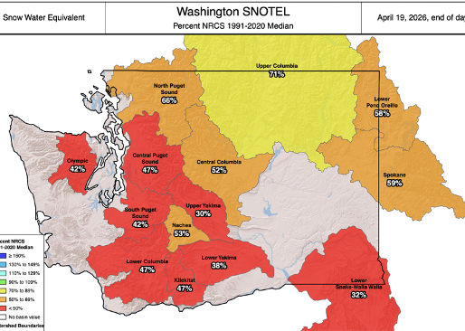
What happened this winter? PNW 2025–26 recap + what’s ahead.
What went wrong this winter? Warmer temps, bad timing, and a La Niña that didn’t deliver. Here’s what it means—and what to watch next.
3 days ago


Apr 20- El Niño next season? Larry live on Zoom April 22
El Niño is forecast for next winter — but what does that actually mean for Northwest skiers? Larry Schick breaks down the season that was, what's coming, and why it's not the snow death sentence you might think.
4 days ago


April 19 - Sun ahead + where to ski in the PNW
Spring in the PNW. A midweek refresh, then sunshine returns. Here’s where to ski now—plus Emma’s picks.
6 days ago


April 17—Sunny spring conditions + who’s still open
Sunny spring skiing this weekend across the PNW. See who’s still open + join our April 22 Zoom.
Apr 17


Win a $500 Sturtevant’s gift card + more
Take a quick Powder Poobah survey and you’re entered to win a $500 Sturtevant’s gift card + more prizes.
Apr 16


April 12- Still in play → snow midweek, dry Saturday
Not over yet. Snow returns Tuesday and Wednesday, followed by a drier Saturday. See who’s still open and where to get a few more turns.
Apr 12


April 9- Get it while it’s good: sun Friday, snow next week
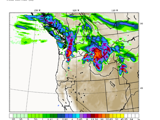
Sunny spring skiing Friday, then a mix of light rain and upper mountain snow this weekend. A stronger system arrives early next week with potential for ~8" at higher elevations. Plus: Crystal conditions recap and updated resort closing dates.
Apr 9


Open Ski Areas in Washington and Favorites
Who is open for skiing and snowboarding. Washington, Oregon, Canada and more
Apr 6


April 5- Get it while it’s good — sun now, a touch of snow midweek
Sunny spring conditions and soft turns to start the week, with a midweek cooldown bringing a touch of new snow. See who’s still open.
Apr 5


April 2- Fresh snow overnight + who’s still open this spring?
Kick off April with sunshine. Take a look at which resorts are open, and read the latest trip reports from Andrea on Whitefish, MT and Fernie, B.C.
Apr 1


Fernie Alpine Resort Guide: It’s worth the trip
Fernie, BC was on the bucket list — and it did not disappoint. Five bowls, big mountains, and a town good enough to make you stay an extra night.
Apr 1


Ski Whitefish, Montana: Road Trip from Seattle
We drove from Seattle to Whitefish, MT and skied four days. The mountain is bigger than you think and the town is better than you expect. Skiable Acres: ~3,000
Base Elevation: 4,464 ft
Summit Elevation: 6,817 ft
Apr 1


March 29- Light snow, sun breaks ahead + Larry's Crystal & Whistler trip report
Enjoy prime spring conditions this weekend with sunny skies, cool mornings, and soft afternoon snow. Light snow returns near Mt. Baker Sunday, with more in the extended forecast.
Mar 29


March 26: Sunny + soft turns for prime spring conditions
Enjoy prime spring conditions this weekend with sunny skies, cool mornings, and soft afternoon snow. Light snow returns near Mt. Baker Sunday, with more in the extended forecast.
Mar 26


March 22: Monday sun → Wednesday snow (5–8")
Monday should be a great day to enjoy some sun and spring conditions for the afternoon. Wednesday, expect snow!
Mar 22


March 19- Friday: Snow levels drop, drier weekend ahead.
After a warm, rainy pattern, snow levels drop to 3,000 feet Friday. Expect a drier weekend with sun breaks, and snow returning to the Cascades next week.
Mar 19


March 14- Rain through Friday. snow returns Saturday.
Sunday is the best day to ski or ride before rain returns next week. Powder Poobah’s forecast looks at rising snow levels, an atmospheric river, and snow returning by Saturday.
Mar 14


March 11- More new snow! Larry's highlights for you.
Wow! As promised, snow is dumping in the Cascades and there is much more snowfall to come - as in several feet.
Mar 11


March 9- Great news from the Poobah, (2-5 ft, or more) of new snow in the Cascades this week.
March 9- Expecting 2-5' or more. Great news from the Poobah
Mar 9


March 7- Is a March Miracle heading our way?
March 7- is a March miracle on the way!
Mar 6
bottom of page